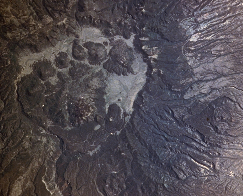
Viewed from the Space Shuttle (looking southeast), the Valles caldera volcano is the dark
oval area nearly filling the left side of the image. The volcano is about 80 km across and
1.5 km tall, even flatter than a basaltic shield volcano. Most of the volcano landform
is lava and ash - the center or caldera is the source of all the action. |
|
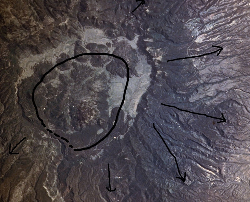
Prelude Another Space Shuttle view of the Valles caldera (the rough oval in the
left 2/3 of the scene). At the top right are the town of Los Alamos and its National
Laboratories. The story begins about 1.2 million years ago, as a blob of water-rich granite
magma (~a million cubic kilometers) rose towards the surface.
|
Ring fracture and Eruption. As the magma neared the surface, it broke the overlying
rock along a ring fracture (black line and erupted at about 1.14 million years ago.
As the magma erupted, water dissolved in it flashed
to steam, spraying the magma as huge clouds of ash and steam. This fiery cloud surged
downhill like water (arrows), and deposited its ash in a of
ash-flow tuff, up to hundreds of meters thick. The ash-flow tuff, named the Bandelier tuff,
has a volume of ~ 300 cubic kilometers!
|
|
Caldera and Lake. During the eruption, the plug of rock bounded by the
ring fracture settled down into the rapidly diminishing body of magma. Steep walls surrounded
where the plug had been, and they collapsed as massive landslides into the hole
left by the sinking plug. The heads of those landslides are now the topographic rim of
the caldera (black line), which is 20-24 km in diameter and about 300 m deep.
Rain water and snow melt then filled the caldera, although one can imagine that lake
to be steaming hot and sulfurous from the eruptions just finished and ongoing. But eruption of the
Bandelier tuff was not the final act of the Valles caldera.
|