Image Processing Experiments in the Classroom
This web site describes image processing experiments that LPI uses in its
educational outreach programs. These activities have been used successfully
with fifth and sixth grade students but can be easily adapted for use in
higher grades. We begin by discussing grayscale ("black and white") images in
the first lab and progress to color images in later labs.
Basic Instructions on getting started (PDF Format).
Grayscale Images
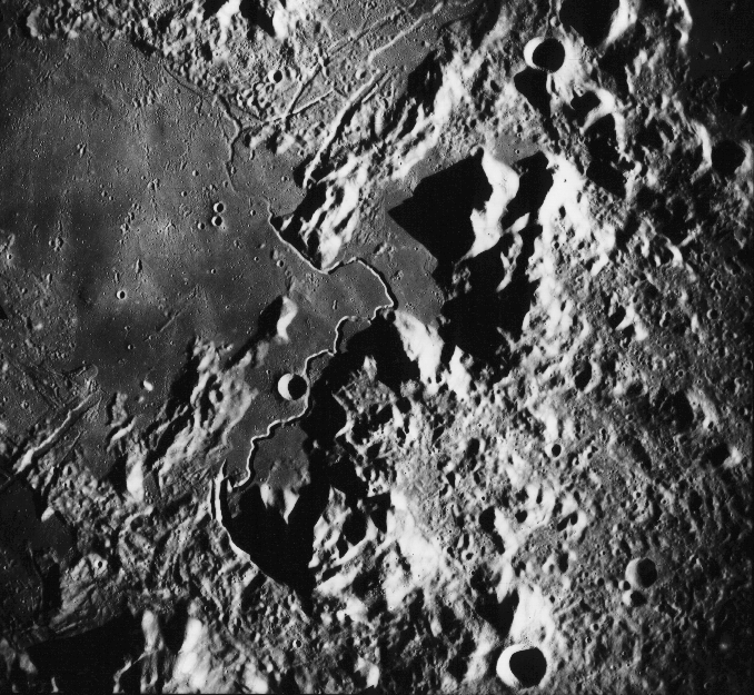
 Apollo 15 Landing Site
The sinuous feature running up the center of the image is Hadley Rille, which
formed as a volcanic channel. Apollo 15 landed in the smooth plains to the
east (right) of the rille. The rough terrain on the right side of the image is
the Apennine Mountains. The image is about 150 km across.
 Valles Marineris
Valles Marineris is a gigantic trough system on Mars. It is 4000 km long (long enough
to stretch from California to Washington D.C.) and up to 10 km deep. It formed when
forces inside Mars stretched the crust, forming long faults. The channels on the walls
of the trough were eroded later, probably by flowing water.
The image is about 540 km across.
 Landslide in Valles Marineris
This image looks obliquely at one of the walls of Valles Marineris. A large landslide
occurred on the wall and flowed across the floor of the trough, toward the bottom of the
image. The image is about 60 km across.
 Martian Channels
This image shows a system of channels on Mars. The channels were cut by rapidly
flowing water, which flowed from the high terrain in the lower left toward the plains
in the upper right.
The image is about 225 km across.
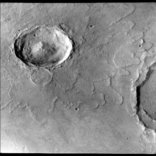
 Yuty Impact Crater, Mars
The depression in the upper left part of the image is the crater Yuty, which formed
when a small asteroid or comet struck Mars. Most of the material that was thrown out
of the crater was deposited just outside the crater rim, forming the distinct lobes
of ejecta. Yuty is 18 km in diameter.
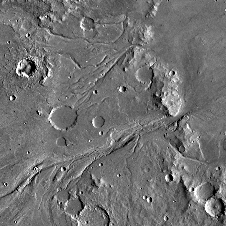
 Martian Ridges
This image shows numerous long ridges on the martian surface. The ridges are faults
which formed when forces inside Mars compressed this part of the crust and pushed up the
ridges. Many small to medium size impact craters are also visible.
The image is about 100 km across.
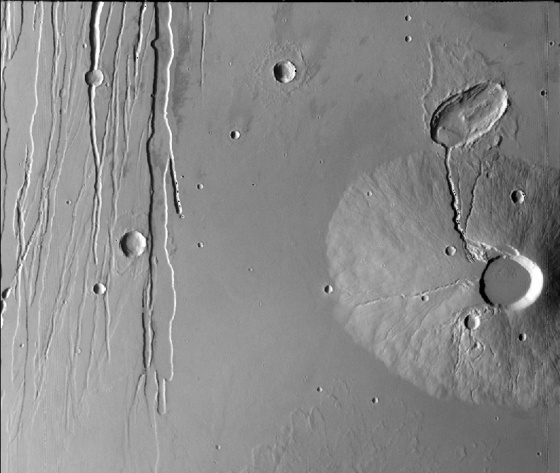
 Ceraunius Tholus Volcano, Mars
On the right side of the image is the shield volcano Ceraunius Tholus, which is
100 by 130 km across and 6.6 km high. Several lava channels are on the north and west
sides of the volcano. On the left side of the image are a set of graben, which are narrow
valleys formed when forces inside Mars stretched the crust and created long faults.
The image is about 215 km across.
Color Images
 Hubble Space Telescope View of Mars
This image shows Mars as viewed by the Hubble Space Telescope in 1999. The north polar
cap is at the top of the image. The storm system near the polar cap is 1600 km across.
 Frost at the Viking 2 Landing Site
This image shows the view from NASA's Viking 2 lander. In this wintertime view, thin
patches of white water frost cover parts of the surface. The reddish regions are rock
and soil that are not covered by frost.
 Sojourner Rover on Mars
The Sojourner Rover was part of NASA's 1997 Mars Pathfinder mission to Mars. In this
image, the rover is studying the rock "Yogi". Yogi is probably a volcanic rock and shows
two distinct colors in this image. The gray color on the right is the rock, and the
red color on the left is a coating of dust. The rover is 62 centimeters long and 32
centimeters high.
Image Sources
Our labs focus on images of the Moon and Mars, as shown above.
With a suitable choice of images, you can customize these activities to match the
focus of your course. Additional planetary images are available from the
Planetary Photojournal.
Astronomy courses could use images from the
Hubble Space Telescope.
Geography, geology, and environmental science courses could use images of the
Earth from space.