
Apollo 10 Mission
Mission Photography
Approximately 70% of the total photographic objectives were accomplished, including about 75% of the requested lunar photography and about 60% of the specified targets of opportunity. Considerable farside photography was obtained, including some areas at the eastern limb where only poor imagery had existed.
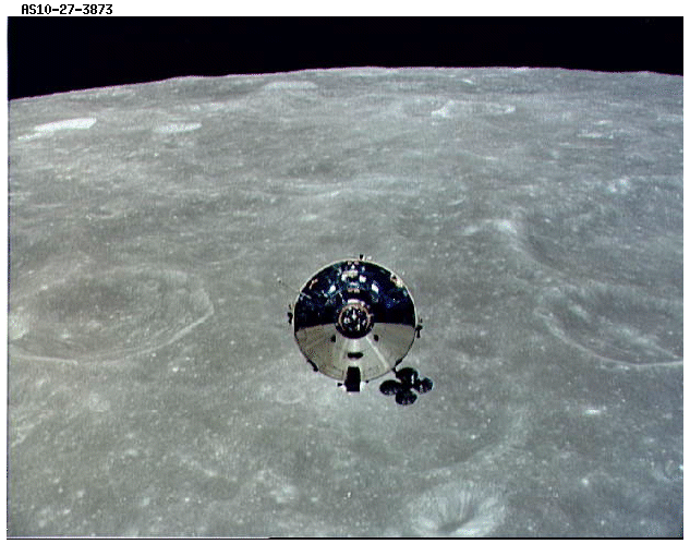 This photograph was taken from the Apollo 10 lunar module, which was being inspected by the command module pilot. The lunar background in this view is a portion of the region east of Mare Smythii.
The flight of Apollo 10 permitted features on the lunar surface to be observed from an altitude of 50,000 feet, within the range of high-performance aircraft on Earth. Much of the groundtrack of Apollo 10 covered unknown parts of the Moon with observations and photographs from orbital altitudes of 60 nautical miles. The color television camera permitted the crew to share many of the frontside observations with people on Earth. The spacecraft remained in the vicinity of the Moon much longer than did the Apollo 8 spacecraft. This allowed more time for extended coverage of an unphotographed segment of the Moon from the vicinity of Apollo Landing Site 2 to the area of Apollo Landing Site 3.
Cameras and Accessories
 The onboard cameras for the Apollo 10 mission were modified Hasselblad 500 EL cameras, with 80-millimeter and 250-millimeter Zeiss panacolor lenses. For certain photographs of the lunar surface, a 60-millimeer lens with a reseau was used. Use of this lens and reseau is apparent in the views that show crosslike fiducial marks. For analytical purposes, black-and-white emulsions were determined to provide a higher degree of resolution and image clarity than the color emulsions; therefore, much of the photography is black-and-white.
Orbital Photography
The crew timelines used for this mission duplicated those for the lunar landing mission, with the exception of the actual descent to the surface. Visual observation and stereo photography of Apollo Landing Site 2, the planned location of the first lunar landing, were to be completed when the lunar module made a low-level pass over Apollo Landing Site 2. The pass was highlighted by a test of the landing radar, visual observation of lunar lighting, stereo photography, and execution of the phasing maneuver using the descent engine. The lowest measured point in the trajectory was 47,000 feet from the lunar surface. The following photographic objectives were included in the mission: (1) the relative motion of the S-IVB during transportation and the docking ejection operations, (2) the lunar module, with emphasis on the landing gear struts, (3) the relative motion of the two spacecraft during rendezvous operations, (4) crew intravehicular tasks and mobility, and (5) lunar surface photography for vertical stereo strip coverage, oblique strips of the lighted landing sites, vertical stereo strips of a proposed highlands landing site, and specified targets of opportunity.
 The Earth as it appears from a distance of 36,000 nautical miles is shown here. North America is the dominant land mass, with the southwestern regions of the U.S. and the northern areas of Mexico clearly visible. At the lower right, the outline of the uppermost portion of South America can be distinguished.
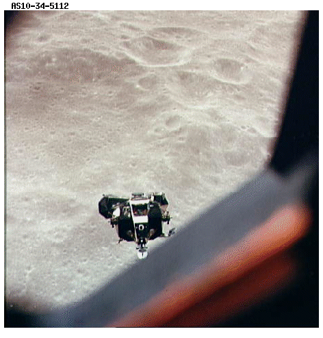 This image shows the lunar module ascending to the command module after descending as low as 47,000 feet above the lunar surface. One of the photographic tasks of Apollo 10 was to photograph the area of Landing Site 2 from a low altitude while testing the operational capabilities of the lunar module. This view is from the command module window.
Apollo Landing Site 2
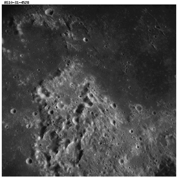
The image to the left is a high oblique view, looking east across Mare Tranquillitatis. The landing site for Apollo 11 is near the bottom center of the picture. The crater in the lower right is Moltke (named for a Prussian general, 1800-1891). The large crater at the upper left is Maskelyne. The image to the right is a vertical photograph of Apollo Landing Site 2.
Bob's Bend and Barbara Mesa
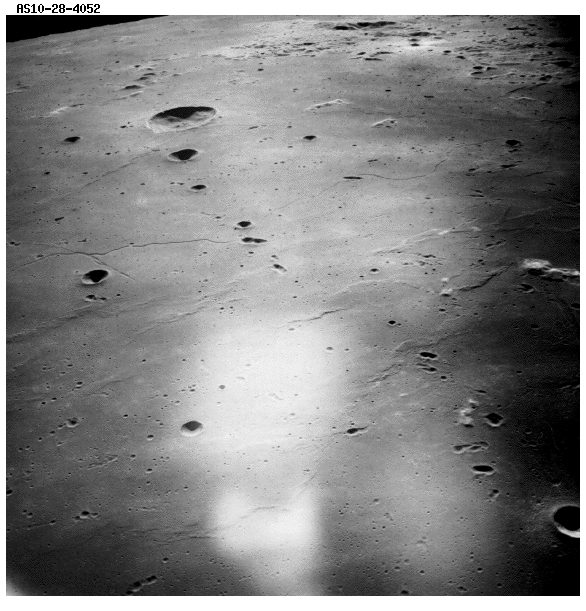
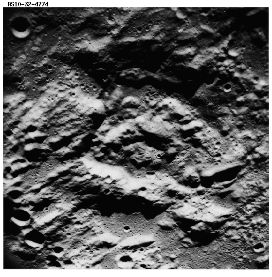
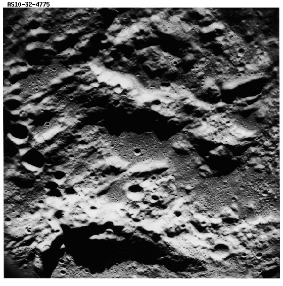
 This is a near-vertical view of the southern edge of Mare Tranquillitatis. The semicircular feature in the upper left corner is Maskelyne D, a significant landmark on the approach to Tranquility Base. Maskelyne D is sometimes referred to as “Bob’s Bend.” Similarly, the peninsular-shaped land mass has been referred to as “Barbara Mesa.” These are operational nicknames given to distinctive or unusual landmarks by the Apollo 10 astronauts.
Stereo Strip Photography
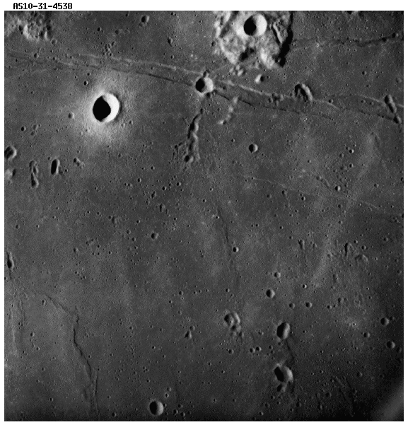
These are stereoscopic photographs of the area between Lade and Rhacticus Craters showing a chain of subround craters transverse to the Imbrium radial fractures (lower left-hand corner of left-hand frame). The objective of the stereo strip photography was to obtain vertical coverage of the lunar surface from terminator to terminator. This strip would be used to update the position of the features on the lunar surface. Each photograph was to overlap the previous photograph by approximately 60% to allow viewing of the surface from photograph positions separated by about 16 miles. This overlap would permit stereoscopic viewing of surface features and mathematical determination of their position.
Summary
Considerable photography was obtained during the Apollo 10 mission and landmark and tracking data were used to reduce the size of the landing ellipse for Apollo 11. During the mission, all nine magazines of 70-millimeter film and 15 of the 18 magazines of 16-millimeter film were exposed. Special care was taken in the selection, preparation, calibration, and processing of flight film to maximize the information retrieval from returned exposures. Processing standards similar to those for Apollo 8 film were used. No exposure problems existed on this mission and results are excellent. Approximately 70% of the total photographic objectives were accomplished, including about 75% of the requested lunar photography and about 60% of the specified targets of opportunity. Considerable farside photography was obtained, including some areas at the eastern limb where only poor imagery had existed. The photography also contains a number of views of the approaches to Landing Sites 2 and 3.
