NASA’s Mars rover Opportunity is studying the area of contact between a rock layer formed in acidic wet conditions long ago and an even older one that may be from a more neutral wet environment.
NASA’s Mars Exploration Rover Opportunity used its navigation camera (Navcam) to record this image of the northern end of “Solander Point,” a raised section of the western rim of Endeavour Crater. Image credit: NASA.
This geological contact line recording a change in environmental conditions billions of years ago lies at the foot of a north-facing slope, “Solander Point,” that the rover’s operators chose months ago as Opportunity’s work area for the coming Martian southern hemisphere winter.
Opportunity has survived five Martian winters since it landed on Mars in January 2004. A northern slope would tilt the rover’s solar panels toward the winter sun, providing an important boost in available power.
Three months ago, the mission began a trek of about 1.5 miles (2.4 kilometers) from an area where Opportunity worked for nearly two years, on “Cape York,” to reach Solander Point for the winter.
“We made it,” said Opportunity’s project scientist, Matt Golombek of NASA’s Jet Propulsion Laboratory, Pasadena, Calif. “The drives went well, and Opportunity is right next to Solander Point. We know we could be on that north-facing slope with a one-day drive, but we don’t need to go there yet. We have time to investigate the contact between the two geological units around the base of Solander Point. Geologists love contacts.”

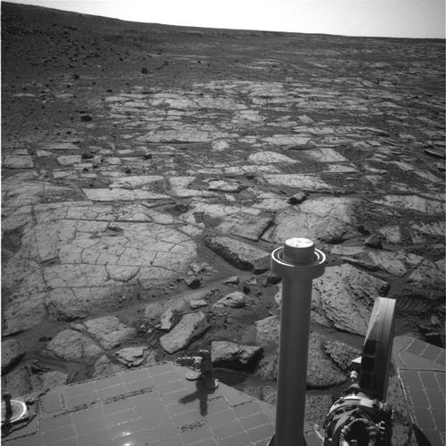
This view from NASA’s Mars Exploration Rover Opportunity shows an area where a pale-toned geological unit called the “Burns Foundation,” in the foreground, abuts a different geological unit.