Terrain that NASA’s Curiosity Mars rover is now crossing is as smooth as team members had anticipated based on earlier images from orbit.
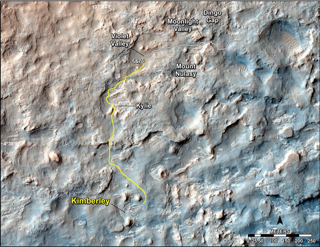
This map shows the route driven and route planned for NASA’s Curiosity Mars rover from before reaching “Dingo Gap.” Image Credit: NASA/JPL-Caltech/Univ. of Arizona.
On Tuesday, Feb. 18, the rover covered 329 feet (100.3 meters), the mission’s first long trek that used reverse driving and its farthest one-day advance of any kind in more than three months.
The reverse drive validated feasibility of a technique developed with testing on Earth to lessen damage to Curiosity’s wheels when driving over terrain studded with sharp rocks.
However, Tuesday’s drive took the rover over more benign ground.
“We wanted to have backwards driving in our validated toolkit because there will be parts of our route that will be more challenging,” said Curiosity Project Manager Jim Erickson of NASA’s Jet Propulsion Laboratory, Pasadena, Calif.

This look back at a dune that NASA’s Curiosity Mars rover drove across was taken by the rover’s Mast Camera (Mastcam) during the 538th Martian day, or sol, of Curiosity’s work on Mars (Feb. 9, 2014). Image Credit: NASA/JPL-Caltech/MSSS.
The rover team used images taken from orbit to reassess possible routes, after detecting in late 2013 that holes in the vehicle’s aluminum wheels were accumulating faster than anticipated. Getting to the chosen route, which appeared to be less hazardous for the wheels, required crossing a 3-foot-tall (1-meter-tall) dune. Curiosity crossed the dune on Feb. 9.
Erickson said, “After we got over the dune, we began driving in terrain that looks like what we expected based on the orbital data. There are fewer sharp rocks, many of them are loose, and in most places there’s a little bit of sand cushioning the vehicle.”
The mission’s destinations remain the same: a science waypoint first and then the long-term goal of investigating the lower slopes of Mount Sharp, where water-related minerals have been detected from orbit.