|
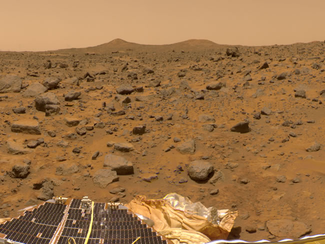
This image shows the view to the west of the Pathfinder landing site. At the bottom, portions of the spacecraft's solar panels and airbags are visible. Pathfinder landed in the outflow region of the Ares Vallis, an outflow channel similar to Maja Valles (slide #24). Many rocks are visible in this image and may have been transported to this region by massive floods early in the history of Mars. A pair of hills known as “Twin Peaks,” located about 1 kilometer from the Pathfinder lander, can be seen on the horizon. It is thought that the Twin Peaks may be a small-scale version of the streamlined deposits shown in slide #25. The streamlined crater deposits in slide #25 are about 150 kilometers northeast of the Pathfinder landing site but are part of the same outflow channel system. As with the previous slide, this slide is actually a mosaic of many individual images, and there are some misalignments visible in the mosaic. Mars Pathfinder image 81957 Right click here to download a high-resolution version of the image (3.52 MB) |