
|
|
MAPS OF MARS A workshop participant noted that it was difficult to find many kinds of maps of Mars, and impossible to find them in a consistent format. So, here's an possible solution. On this page are maps and images of general properties of Mars in hemispheric views. Clicking on the thumbnail images will call larger versions, ~ 800x600 pixels. Higher resolution images and maps are linked in the text. These are best recovered by a "save link target as" command/click. Links in the captions will also lead to original image sources and related materials. Maps in Mercator projection of similar properties are available on the preceeding page. |
 |
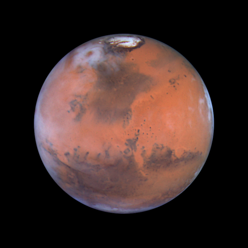
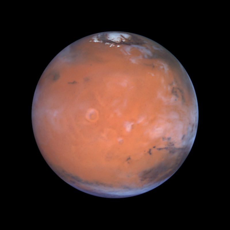
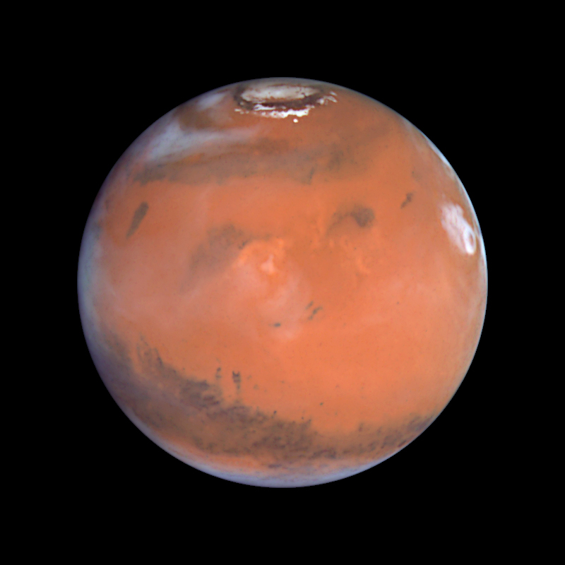
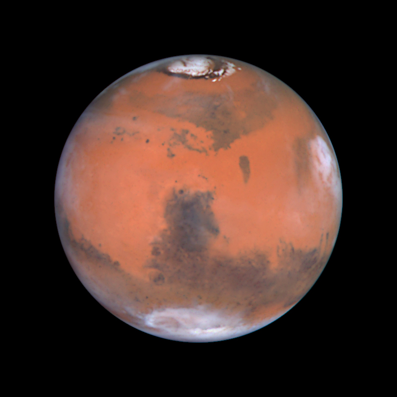
The Hubble Space Telescope has taken lovely images of Mars, which complement the MOC Atlas mercator projection. This image montage is from Mars' 1999 oppoxition. Individual images from the montage, 800x800 pixels (0.2 Mbyte), are available here for Acidalia, Tharsis, Elysium, and Syrtis Major. A much larger version of this montage is available from the Hubble images archive, as are individual hemisphere views centered on Acidalia, Tharsis, Elysium, and Syrtis Major from the Space Telescope Science Institute. Also worth seeing are Hubble images from the 2003 closest encounter, centered on Tharsis, and Syrtis Major. Credit. |
|
 |
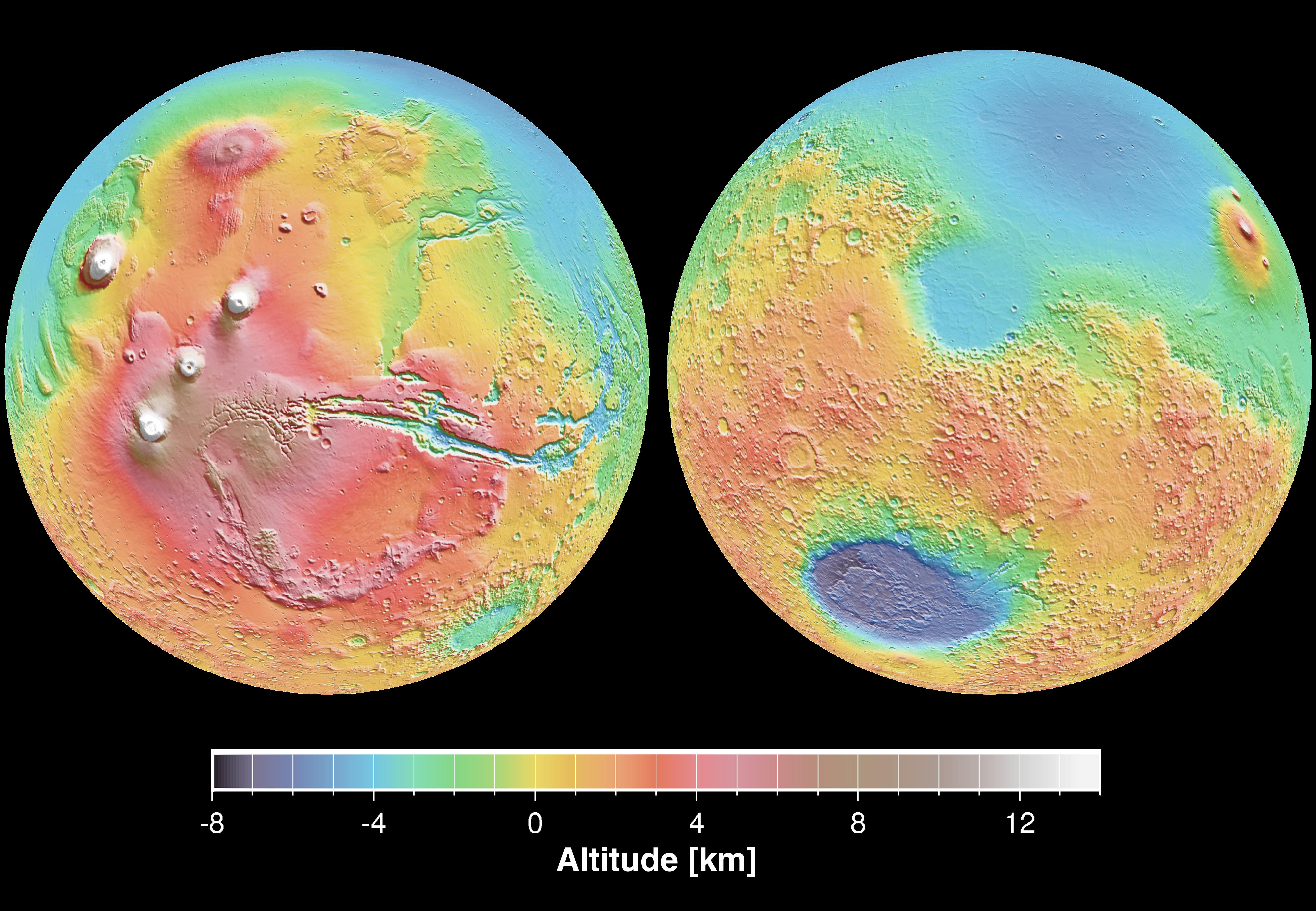
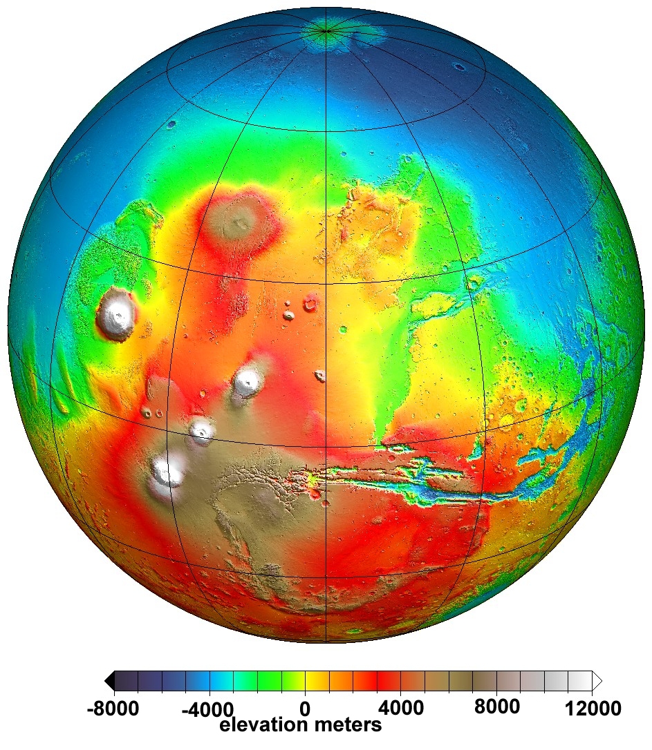
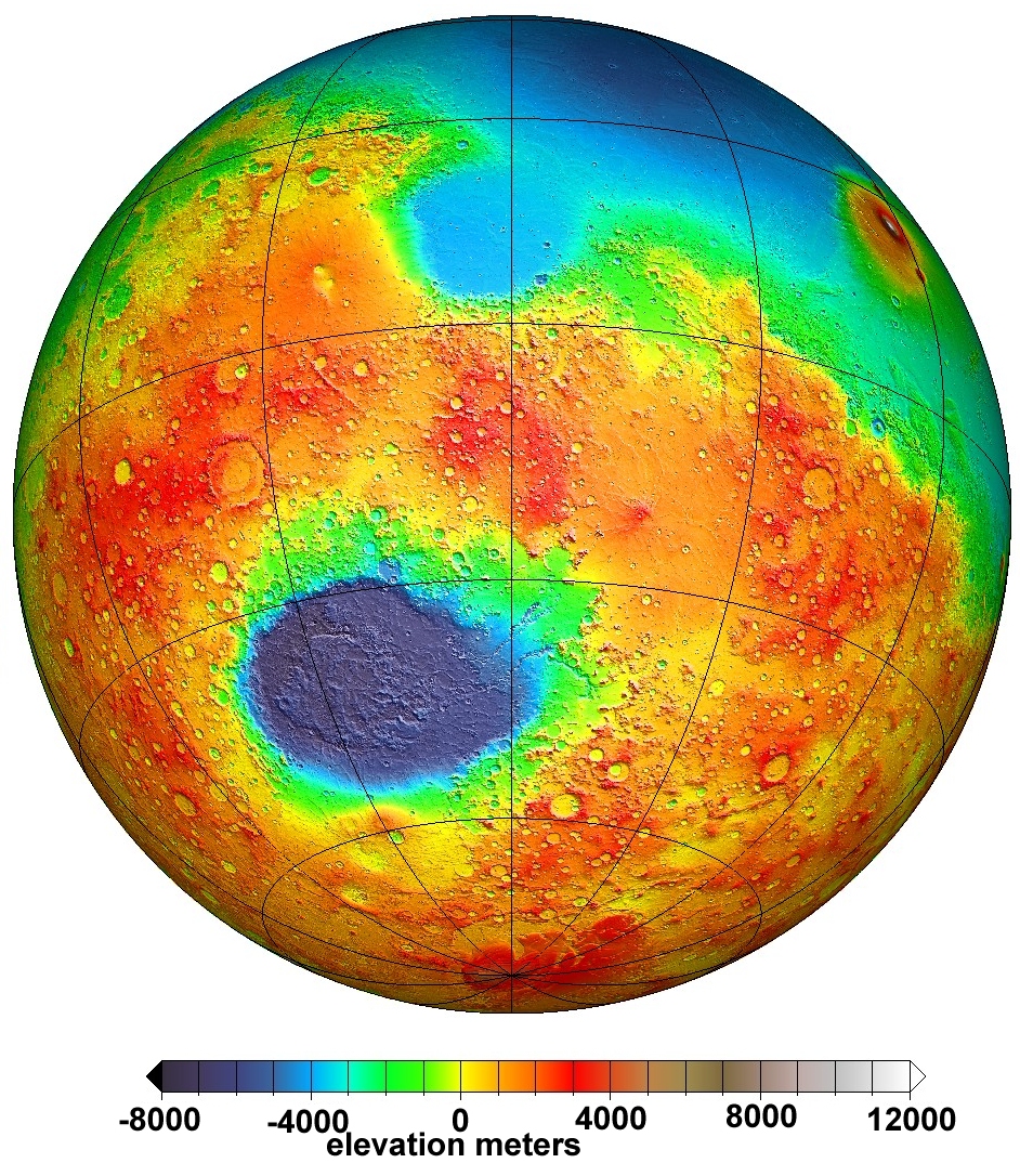
To complement the MOLA laser altimeter Mercator maps of Mars' elevations and topography, the MOLA team also produced views of selected hemispheres. These views emphasize specific interesting areas or angles. These maps show altitude data coded into colors - blue is low and red/white are high. These two hemispheres are centered on the Tharsis plateau (including the Valles Marineris and the large volcanos) and on the Isidis impact basin (with the Hellas basin to the south) For a higher resolution version this image, click here. Look to these links for better quality hemispheres centered north of Tharsis, between the Isidis and Hellas basins, and on the Utopia basin. Credit. |
|
 |
The Mercator projection distorts polar regions beyond recognition, so polar projection maps are commonly made separately. These MOLA shaded topography images of Mars's north and south polar regions are stereographic projections, from latitudes 72 degrees latitute N and S towards the respective poles. The line of 0 degree longitude is to the bottom of the north pole images, and toward the top of the southe pole image. Both poles are covered by layered ice caps with smooth undulating surfaces. The north polar vap sits of a flat plain, while the south polar cap sits on heavily cratered land. Individual high-resolution images are available for the North Pole and South Pole, and much higher resolution images can be downloaded from the MOLA web site. Credit. |
|
 |
Water abundances in the Martian polar regions, from the neutron spectrometer on Mars Odyssey, are shown here to complement the Mercator projections of equatorial regions. The north pole is nearly pure water ice, while the south pole is water iced mixed with other stuff, most likely dry ice and mineral dust. More details are available in the Los Alamos National Lab press release. A larger version of this image is available here, and the very large source version can be downloaded via this site. Credit. |
|
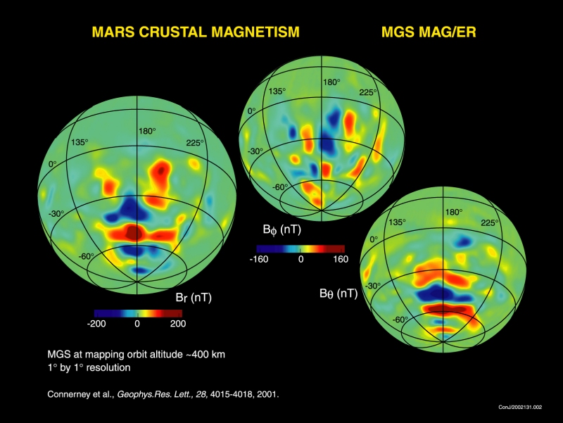 |
The magnetic anomalies found by the MAG/ER experiment on the Mars Global Surveyor spacecraft are inconveniently bisected by the 180 degree longitude line, and so appear at both ends of the standard Mars mercator projection. Here, the MAG/ER team have made hemispheric projections centered on the area of strongest anomalies. The three hemispheres show the three components of the magnetic field: B(r) is the radial field, perpendicular to Mars' surface; B(Θ) is the polar field, oriented along lines of longitude; and B(Φ) is the circumferential field, oriented along lines of latitude. A larger version of this image is here, and the full size image is available at the MAG/ER team web site. Credit. |