
|
|
VALLES MARINERIS AND THE U.S.A. As part of the workshop, we showed several posters comparing geographic scales and geologic features on Mars with those we saw in the Great Desert. This page contains line maps of the USA on topographic images of the Valles Marineris, and more detailed comparisons of the Grand Canyon and the Valles. The following page has posters that compare volcanos and small impact craters on Earth and Mars. The posters are available in moderate size format by clicking on the thumbnail. They are also available as large, multi-megabyte file as directed in the figure captions. To get one of the large-size files, it is probably best to click on "save link as" on your browser. |
|
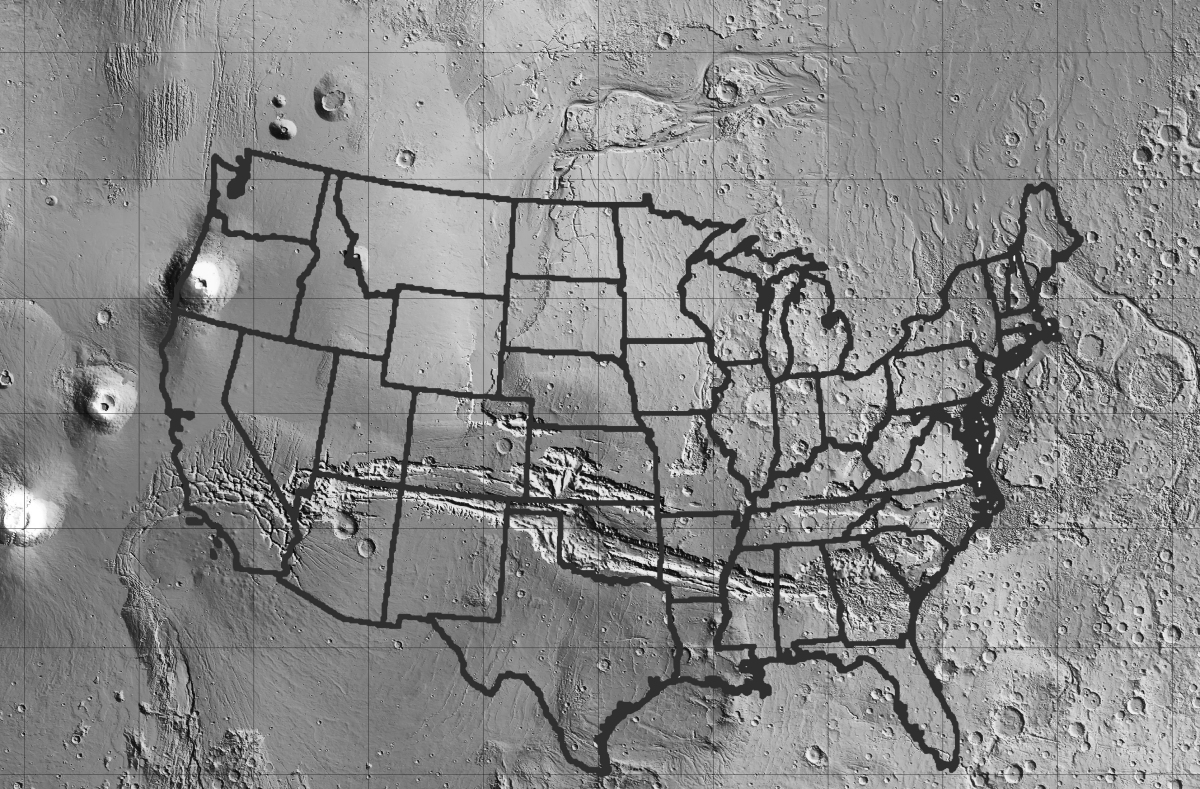
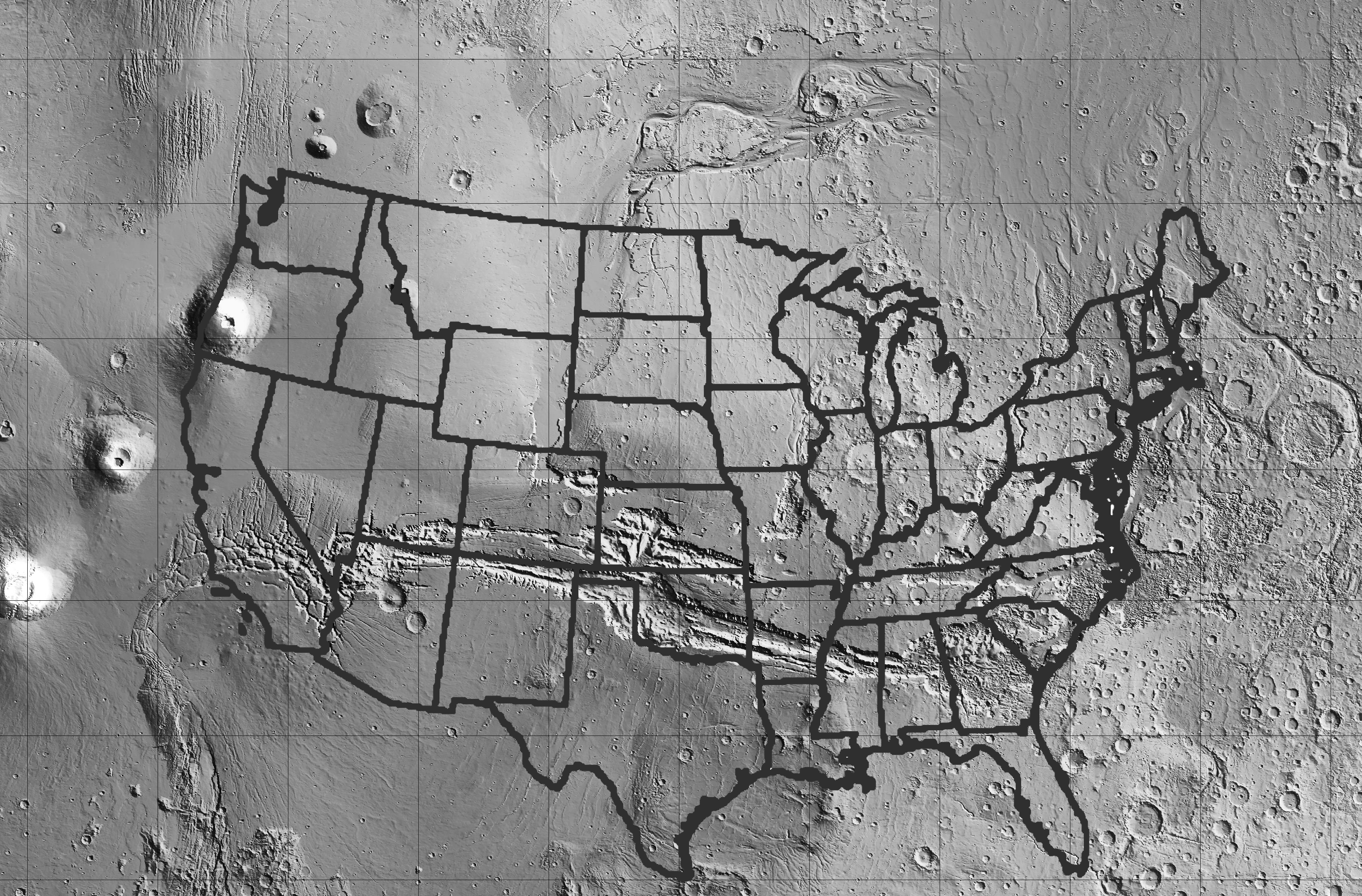
The Valles Marineris is so large that it would stretch all across the North America, from San Francisco to New England and beyond. The Valles Marineris image is from a shaded topographic map from the MOLA altimeter, on the Mars Global Surveyor spacecraft. Credit. Download the full poster (7.2 megabytes) here. |

|
 |
|
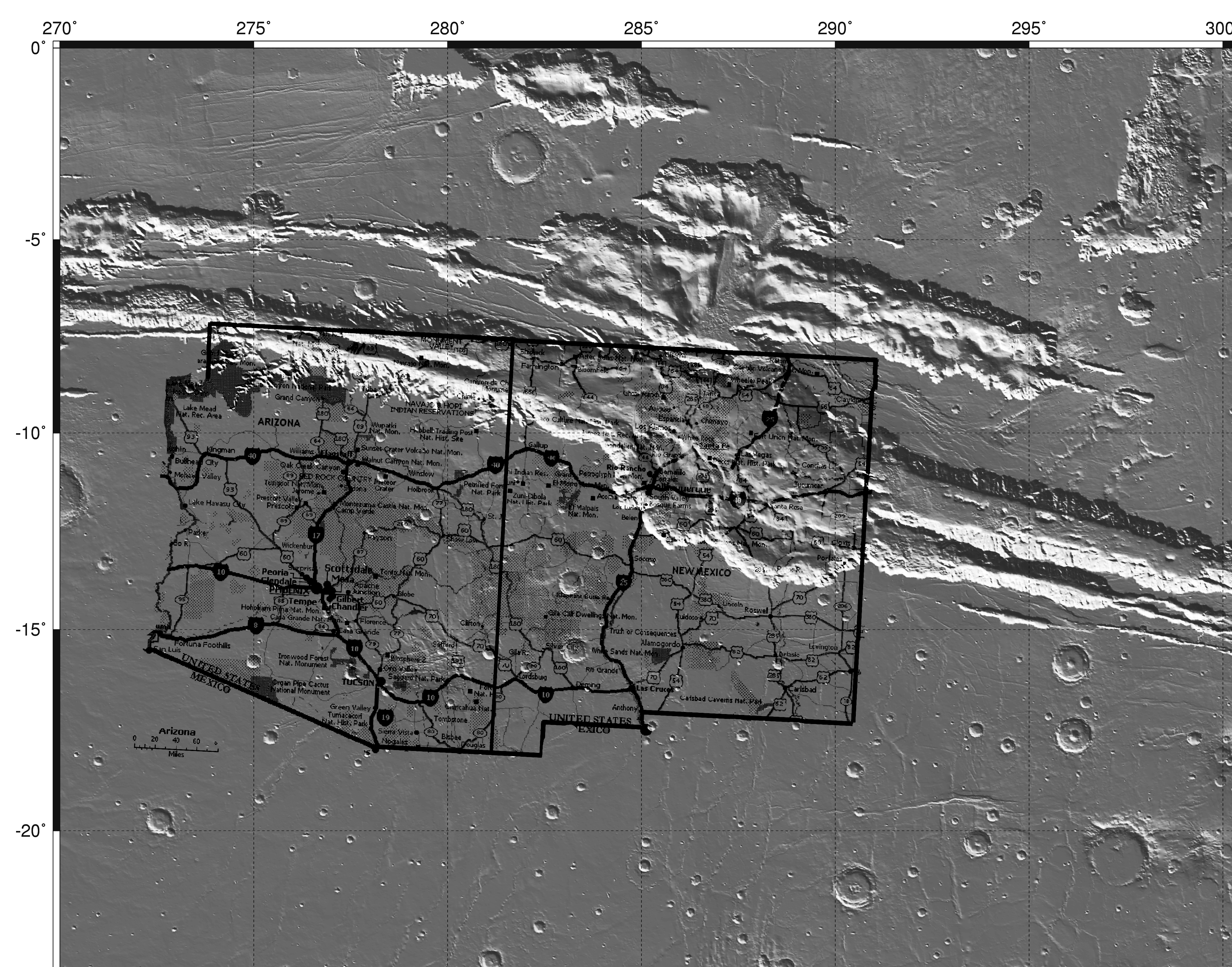
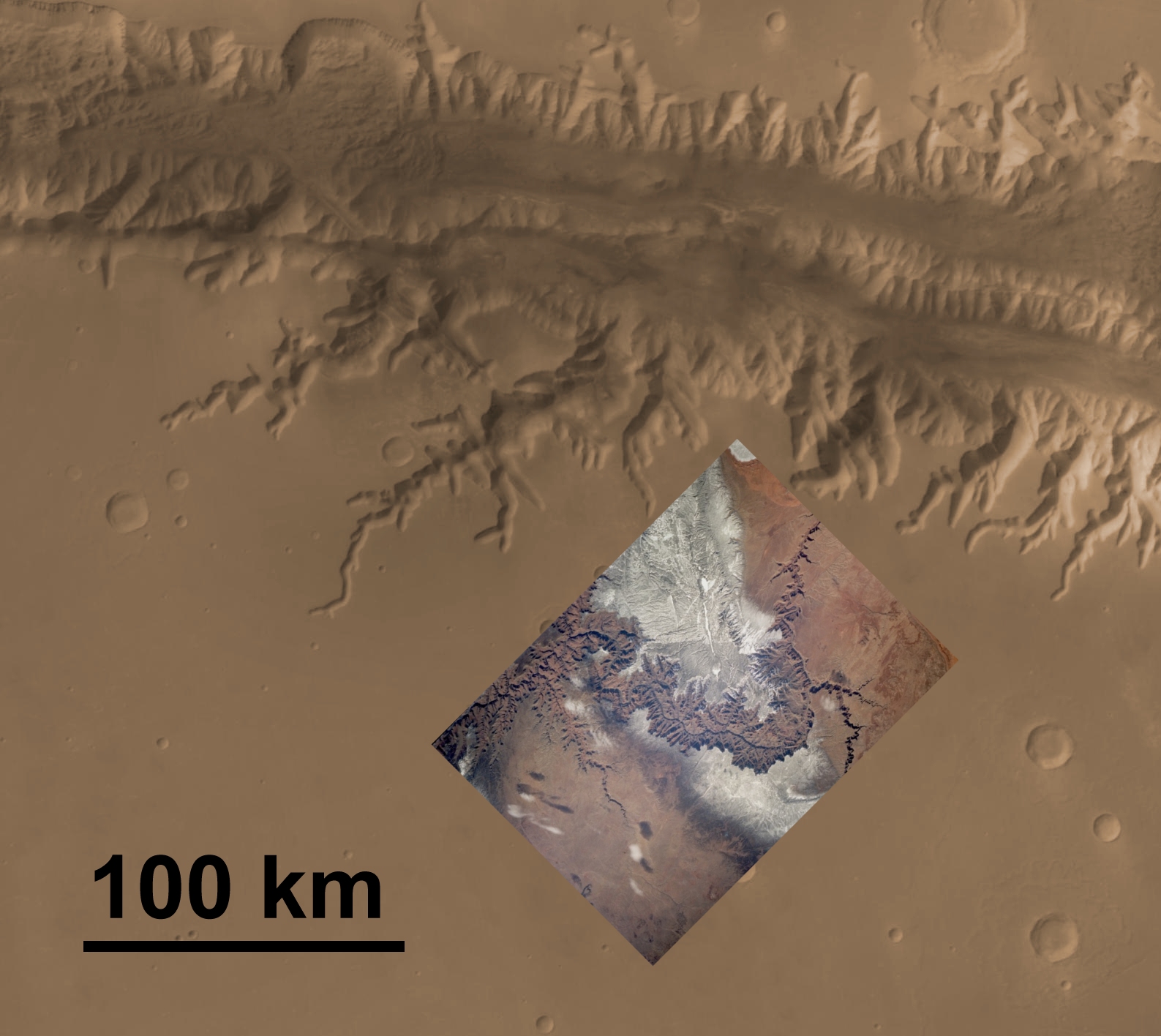
The size of the Grand Canyon, compared to a portion of the western Valles Marineris. This image has both the Mars scene and the road map oriented the same -- north at the top. Remember that our bus ride from Albuquerque to the Grand Canyon took all day -- that gives some idea of the scale of the Valles Marineris, as does the above image of the US map. Valles Marineris image is from the MOC Atlas Mars. Credit. Download the full poster (5.9 megabytes) here. |
The depths of the Valles Marineris and the Grand Canyon. This image of the Valles Marineris wall (Viking Orbiter image F07a123), colorized to approximate the real color, is of a slope almost 10 kilometers tall. The inset is a view of the Grand Canyon from the rim, showing its 1-mile depth (~1.5 km) at approximately the same scale. Copyright. |
|
 |

|
|
|
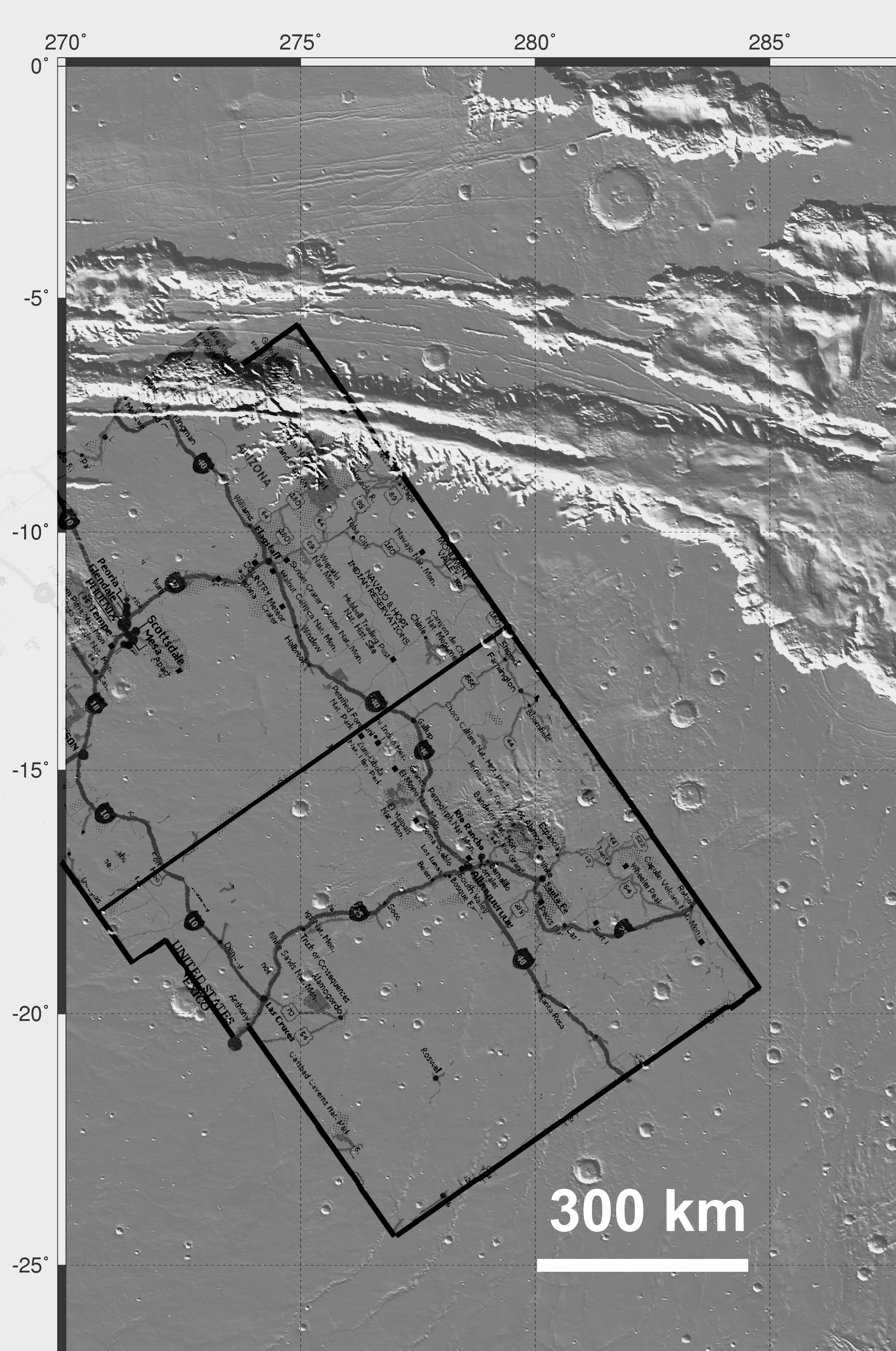
Here, a rotated map
is overlain on part of the western Valles Marineris. This rotation puts
the Grand Canyon along a same-sized tributary canyon of the Valles Marineris, and puts Albuquerque
south of a shield volcano on the plains south of the Valles Marineris. This unnamed shield volcano
is in just about the same location (on this image) as the Valles Grandes caldera complex volcano,
which is not a shield volcano.
Valles Marineris image is from the
MOC Atlas Mars. Credit.
Download the full poster (3.5 megabytes) here. |
The length of the Grand Canyon compared to a minor tributary canyon of the Valles Marineris. Although the sizes of these canyons are similar, they are so different in detail that the Martian canyon could not have been cut to its present form by running water at the surface. Notice that the Martian canyon has very few tributaries, and that its canyons end in rounded "theater-head" walls. On Earth, this type of valley usually forms by collapse of underground channels or caves formed by flowing groundwater. Arroyos in the desert southwest commonly have theater-head ends, as do valleys formed by collapsed caves in limestone country. Valles Marineris image is from the MOC Atlas Mars. Grand Canyon image is from Space Shuttle astonaut handheld camera image STS060-83-5. Copyright. Download the full poster (0.6 megabytes) here. | |