NASA’s Mars rover Curiosity now has a view of a patch of exposed bedrock scientists selected for a few days of close-up study, the first such study since the rover began its long trek to Mount Sharp two months ago.
Curiosity reached the crest of a rise informally called “Panorama Point.” From Panorama Point, the rover took photographs of a pale-toned outcrop area that the team chose earlier as “Waypoint 1” on the basis of imagery from NASA’s Mars Reconnaissance Orbiter.
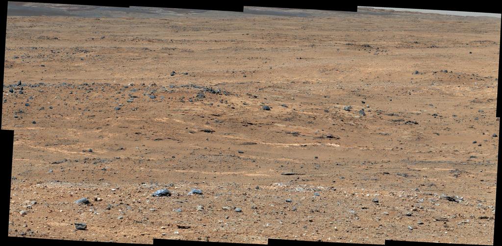
An outcrop visible as light-toned streaks in the lower center of this image has been chosen as a place for NASA’s Mars rover Curiosity to study for a few days in September 2013. Image credit: NASA/JPL-Caltech/MSSS.
Five selected waypoints dot the mission’s route southwestward from the “Glenelg” area, where Curiosity worked during the first half of 2013, and an entry point to the lower layers of Mount Sharp, the mission’s next major destination. Waypoint 1 lies about one-fifth of the way along the approximately 5.3-mile (8.6-kilometer) route, as plotted from examining orbiter images.
Curiosity advanced 464 feet (141.5 meters) on Sept. 5 in the longest one-day drive so far in the 13-month-old mission. The drive toward the elevated Panorama Point combined two segments. For a long initial segment, engineers chose the path from images examined on Earth ahead of time. That was followed by a 138-foot (42-meter) segment, for which the rover autonomously navigated its own path based on images taken during the day’s drive. That Sept. 5 drive plus the next one — 80 feet (24.3 meters) on Sept. 8 — brought the rover to the top of Panorama Point.
The trek to Mount Sharp will continue for many months after the planned work at Waypoint 1.