Digitized Books Barringer Crater Guidebook Laser Scan

Laser Scanning of Meteor Crater’s Interior and Western Ejecta Field
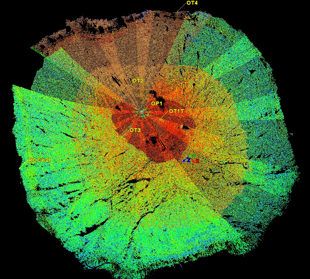
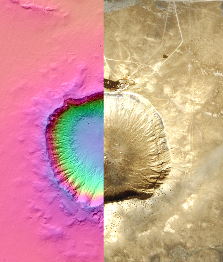
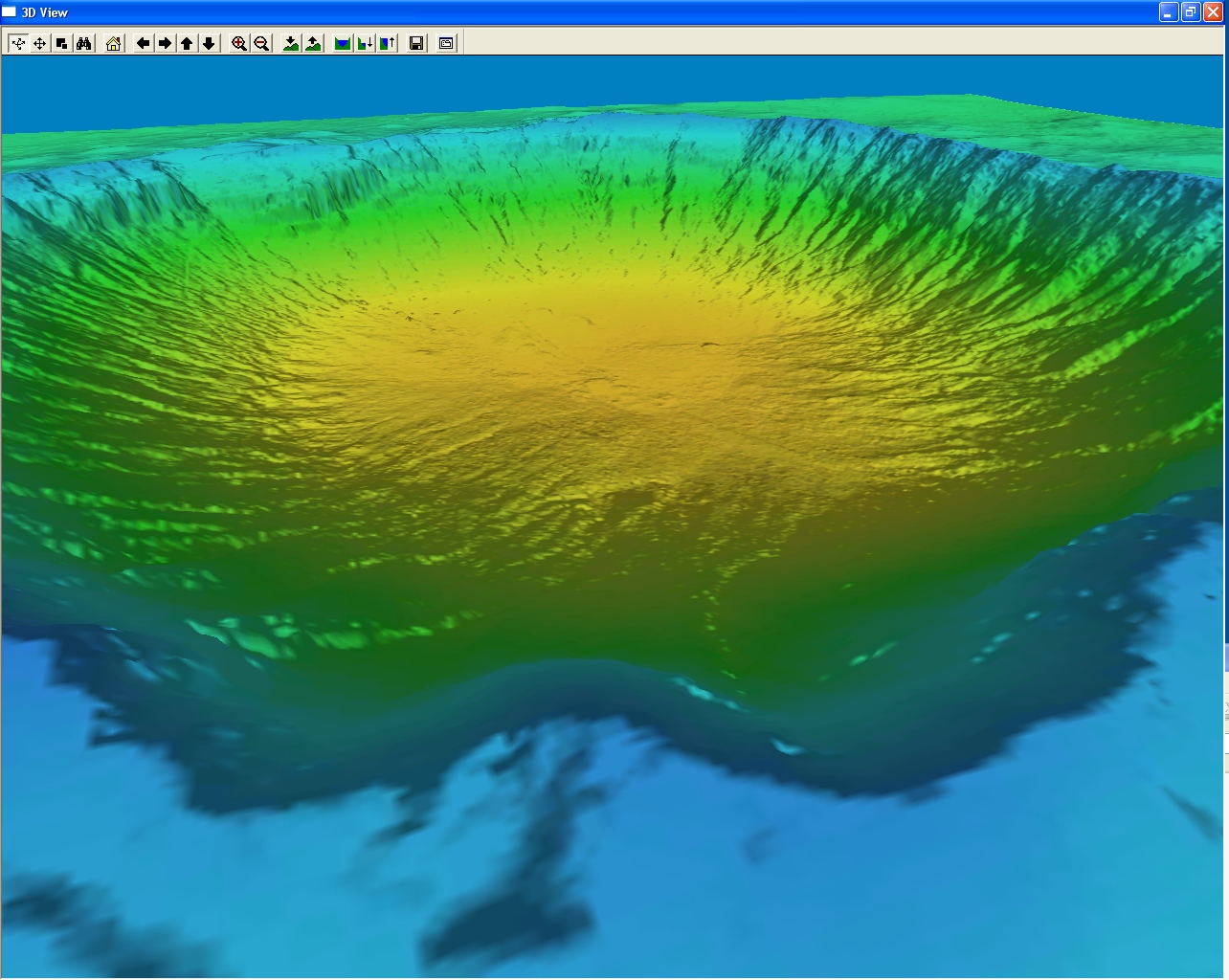
In June 2007, NASA conducted a ground-based laser scan of the crater interior using an Optech ILRIS 3D scanner from the floor of the crater. The scan was implemented over a 5-hour period and locations within the scan were calibrated using reflective targets at known positions. During the same experiment, a scan of a boulder field in the western ejecta blanket was conducted using a Leica HDS3000 laser scanner. The laser data were integrated with a Digital Elevation Map (DEM) produced by a photogrammetric analysis of a QuickBird image that was acquired in October 2006. The data was processed to produce files with decimeter-scale point spacing. Files with 5 and 10 decimeter point spacing are provided for download below.
Credits
These data were collected as part of the following project: High Resolution Planetary Analog Crater Terrain Model for Navigation Studies: NASA Project Integration Office - Stennis Space Center, Mississippi - Rodney D. McKellip, NASA Lead. Data were gathered and processed by Richard Brown, Andrew Navard, and Don Holland of the Applications Visualization Team of NASA’s Applied Science Program at SSC.
Preliminary Report of Project Results
Brown et al. (2008) Creation of High Resolution Terrain Models of Barringer Meteorite Crater (Meteor Crater) Using Photogrammetry and Terrestrial Laser Scanning Methods, Lunar and Planetary Science XXXIX, Abstract #2453.
Examples of Data Products

Gridded Optech scanner data of northwest crater floor at 5 decimeter point spacing with linear filter applied
The scan illustrates the northwest corner of the crater wall, radially-oriented gullies that cross-cut the crater wall, a trail that cross-cuts the gullies, and the relatively smooth crater floor. An aerial image of this portion of the crater is illustrated in Figure 3.1 of the Guidebook to the Geology of Barringer Meteorite Crater, Arizona.
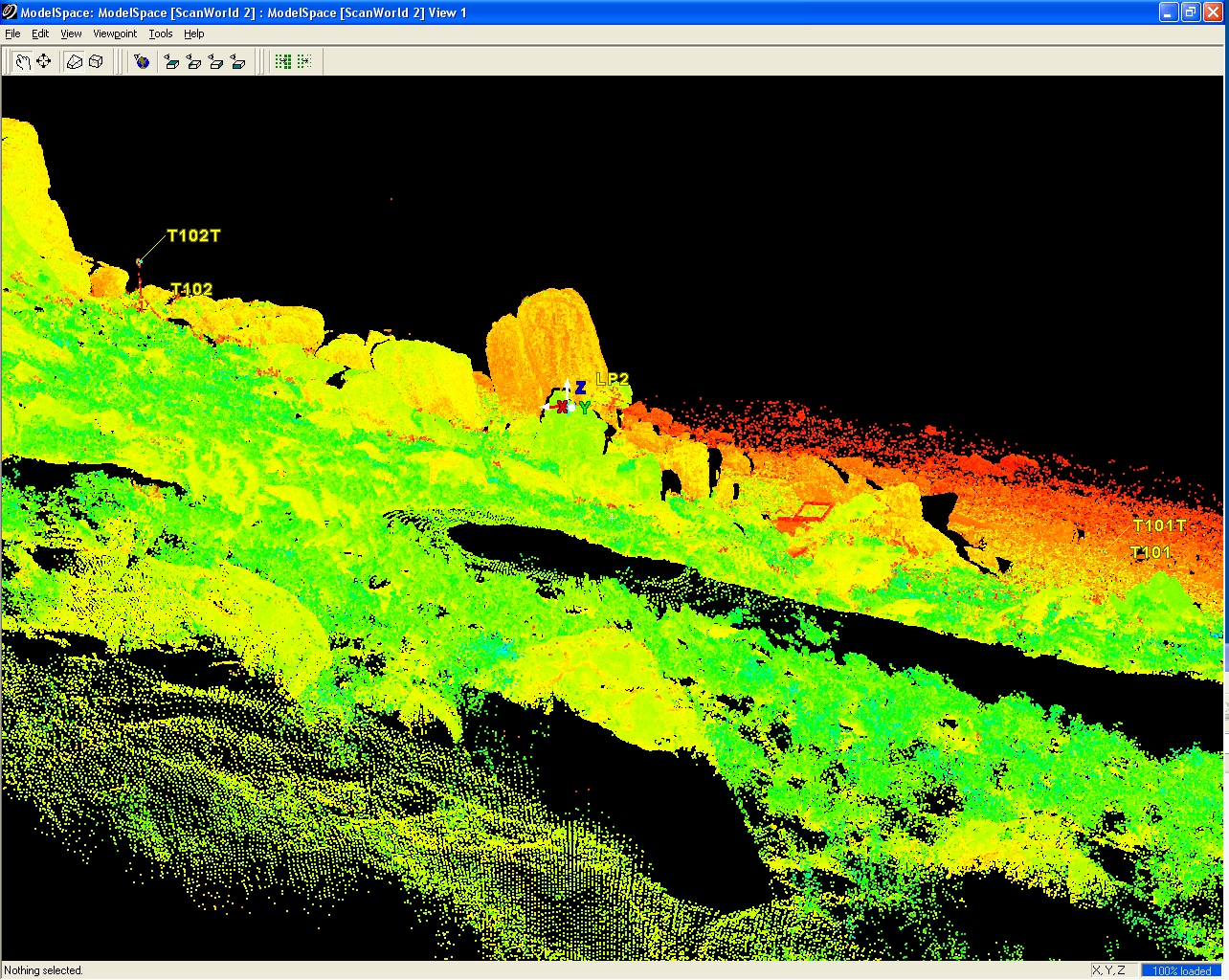
Photographs of the boulders in the western ejecta field are illustrated in Figure 7.2 of the Guidebook to the Geology of Barringer Meteorite Crater, Arizona.
Files for Download
Entire Crater
Raw
ArcGIS
Northwest Crater
Raw
ArcGIS
Western Ejecta Field
Raw
ArcGIS
Back to the Barringer Crater Guidebook main page