|
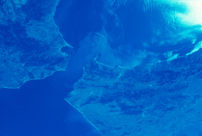
The Strait of Gibraltar is a narrow waterway separating the Atlantic Ocean (bottom left) from the Mediterranean Sea (top right). This 13-kilometer-wide waterway also separates Europe and Africa, with Spain and Gibraltar on the left and Morocco on the right. Until the opening of the Suez Canal in 1869, the Strait of Gibraltar served as the only access point to the Mediterranean Sea. During World War II, naval traffic through this strait was monitored by both Allied and Axis navies, as it served as a crucial “chokepoint” for vessels traveling between the Atlantic and Mediterranean. High rates of evaporation in the relatively shallow Mediterranean basin cause the water to become saltier, and thereby denser, than the relatively fresh Atlantic water. As Atlantic water is forced through the narrow strait it accelerates and interacts with Mediterranean water. Internal waves (particularly those formed at depths of 60–80 meters) develop where these two different water masses interact. Large, tidally induced pulses of Atlantic water entering the Mediterranean can be seen here as a series of crescents emanating from the strait. These crescents result from interactions of these different water masses at depth. October 1984, mission STS-41G, image 17-34-81. Location:
35°40'N, 5°40'W Right click here to download a high-resolution version of the image (8.81 MB)
|