|
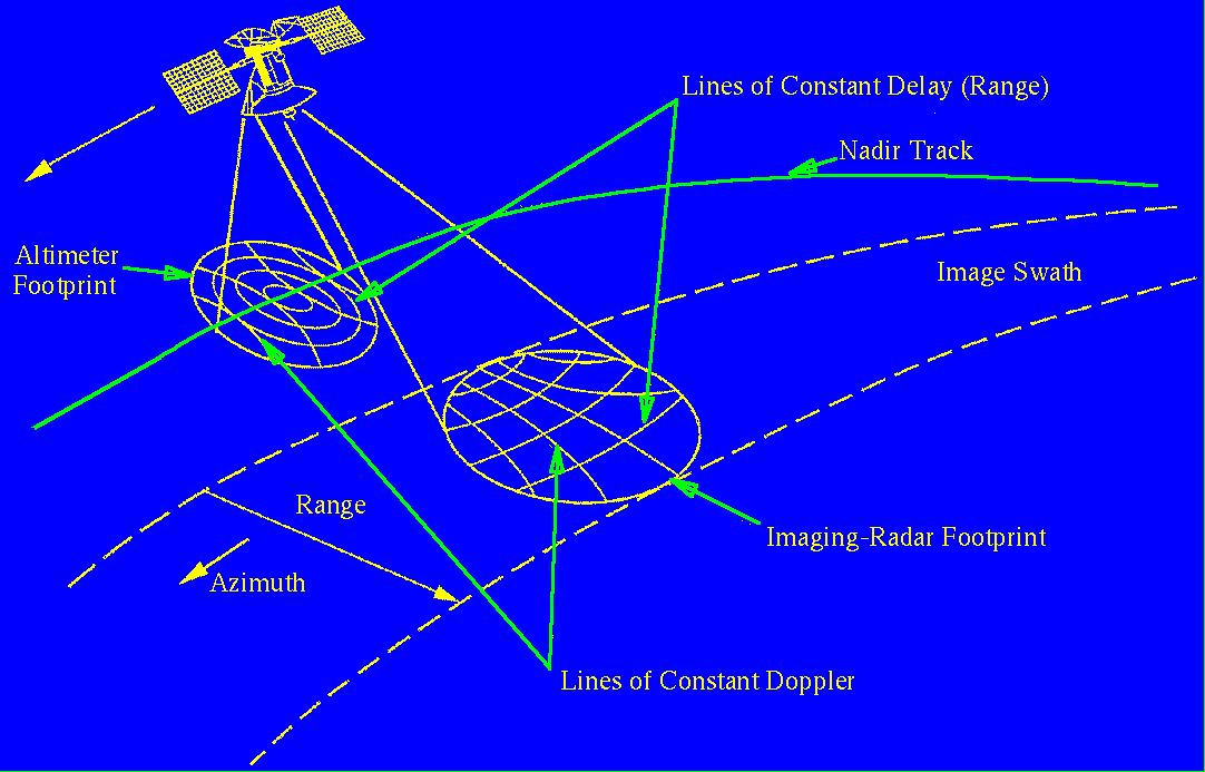
This is a diagram of Magellan mapping the surface of Venus. The radar altimeter horn points straight down (the nadir) while the large radar dish looks off to the side. The altimeter sends out a pulse and then measures the time it takes for the pulse to return, allowing the distance from the spacecraft to the surface (and thus the topography) to be calculated. Because the altimeter footprint's width is several kilometers, returns come in from several different elevations, and a computer algorithm is used to determine the most representative elevation for the footprint. The larger side-looking radar also sends out a pulse and then uses the time and frequency of the returning pulse to construct a radar image of Venus. Radar returns from in front of the moving spacecraft are shifted to higher frequencies, and those from behind are shifted to lower frequencies (lines of constant Doppler shift); returns from closer to the spacecraft arrive before those from farther away (lines of constant delay). The strength of the return at a particular range and Doppler shift determines the brightness of a pixel on the final radar image. Adapted from Guide to Magellan Image Interpretation, JPL Publ. No. 93–24. Click here to view a high-resolution version of the image (16.5 KB)
|
